A Roman Road and the Power of Multispectral Analysis
- Feb 21, 2020
- 2 min read
Check out this set of kite aerial panoramas shot in different wavelengths - that all conspire to show an ancient Roman road.

The first is a visible light panorama of a part of Ljubljana Marshes south of Ljubljana, Slovenia, shot with a Nikon P330. Can you spot a Roman road hidden in the middle of the image? No?

The second image shows the red chanel of a near-infrared panorama, shot with NIR-modified Pentax WG-10. Is the 2.000 years old road visible now?
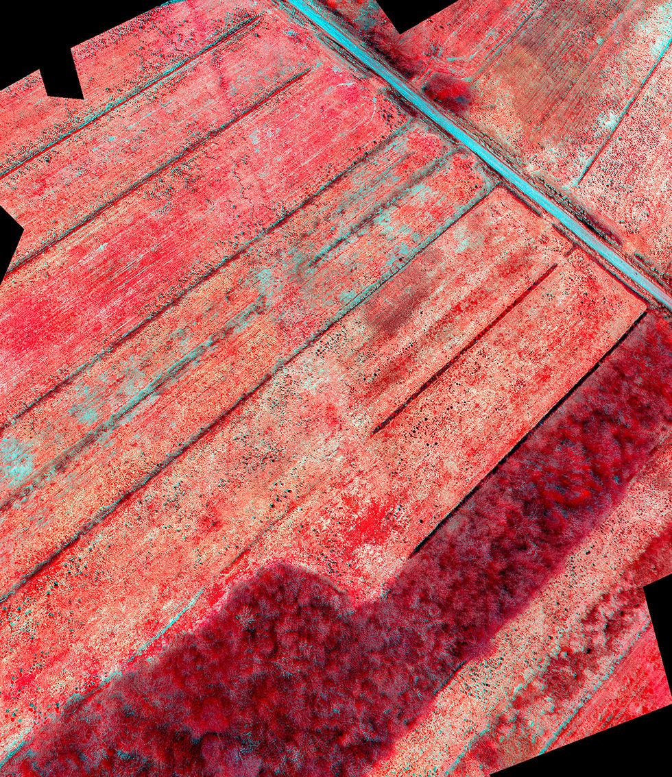
The third is a false colour NIR-G-B composite, where the red channel of a visible light photo is replaced by the near-infrared photo. Even this one doesn’t show but a hint of a road (can you spot it now?) ... So we shall combine all those images in a different way.
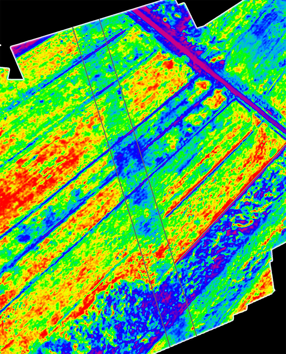
The technique is called NDVI, the normalized difference vegetation index. It is computed from the R channel of a normal photo and a N photo. The values are computed as a ratio between the difference of the channels (NIR-R) and the sum of them (NIR+R) ... NDVI = (NIR-R)/(NIR+R)
NDVI shows, well, the difference in vegetation growth. Plants growing in deep soil prosper and reflect more near-infrared light, while those on shallow soil (say, over a buried Roman road) grow less vigorously and reflect less NIR light. So a NDVI image brings out those differences in quite a spectacular way ... Voilà!

The green-blue band (where plants grow poorly due to shallow soil) crossing from top left to bottom right is - the Roman road!
The road itself is a marvel of Roman engineering, the first road that crossed the Ljubljana Marshes, constructed in the second century AD. After it fell into disrepair and all but disappeared, it took us 1.600 years to build another road that crossed the unstable, flood-prone ground of the Marshes.

Kite aerial panoramas shot with a NIR-modified Pentax WG-10 and a Nikon P330, mounted on a custom-made double Picavet rig and lifted by a delta kite.
Comments